|
|

|
|
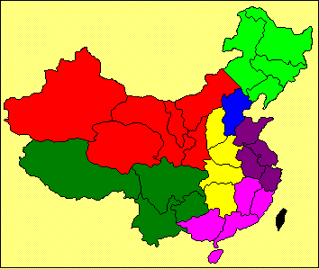
“Chinese Taipei”
is shown in black. Note that we do not have the Chinese name
for “Chinese Taipei” since the name has not yet appeared on official
documents in Chinese. |
|||||||||||||||||||||||||||||||||||||||||||||||||||||||||||||||||||||||
|
|
Capital: Taipei Average temperatures: January temperatures average about 18° C;
warm, humid summers extend from May
until September with temperatures averaging about 28° C. Physical features: The land
area is 36,188 square kilometres, the
length of which is about 360 kilometres and a forested mountain range extends
through most of it. The highest peak,
Yu Shan, reached nearly 4,000 metres above sea level. East of this central chain of mountains is
a sharp drop to the coast, while the west has a broad, fertile plain sloping
gently to the Taiwan Strait. Rivers: All rivers originate in the mountains
and travel relatively short distances.
The longest rivers are the Choshui, Kaoping, Tsengwen, and Tanshui,
which is the only navigable stream. Administrative divisions:
“Chinese Taipei” is divided
into 16 counties, five municipalities, and two special municipalities
(Taipei, the capital, and Kaohsiung).
Each county is subdivided into townships, rural districts or groups of
villages, and precincts. Cultural significance:
The population comprises three main
groups: the Taiwanese (about 84 per cent), who are descendants of the Chinese
who emigrated from Fujian and Guangdong provinces
during the 18th and 19th centuries; the Chinese (about 14 percent), who moved
to the island after World War II (1939-1945); and the aborigines (2 percent),
who are related linguistically to the people of the Philippines and Indonesia
(the Malayo-Polynesian language group, which is also known as
Austronesian). The society traditionally has been
agrarian, but by the late 1980s only about 15 percent of the labor force worked
in agriculture. |
|||||||||||||||||||||||||||||||||||||||||||||||||||||||||||||||||||||||
|
|
Coal: Taipei, Keelung, Taoyuan, Hsinchu, Miaoli,
Nantau and Chiayi Gold: Juifang,
Chinkuashih (Taipei prefecture), Copper: Juifang,
Chinkuashih (Taipei prefecture), Chimei (Hwalien) Pyrites: Chihsingshan, Chinkuashih (Taipei
prefecture), Tananao (Yilan), Tungmeng (Hwalien) Placer Magnetite:
Chinshan, Tanshui (Taipei prefecture), Chuwei (Taoyuan), Chaiyi (Tainan) Limonite: Yaoyuan, Hsinchu, Taichung, Chihsingshan (Taipei
prefecture) Manganese:
Simaoshan (Yilan) Ilmenite (10%):
Taoyuan, Hsinchu, Taichung, Chihsingshan (Taipei
prefecture) Zircon Ore (40%):
Tainan, Chiayi, Hsinchu Monazite (2%):
Tainan, Chiayi, Hsinchu Sulphur:
Chihsingshan (Taipei prefecture), Chinshan, Peitou (Yangmingshan) Asbestos: Fengtien
(Hwalien) Dolomite: Hwalien Marble: Yilan,
Hwalien, Taitung Talc: Yilan,
Hwalien Bauxite: Taoyuan, Hsinchu, Taichung Limestone:
Yilan, Hwalien, Taitung, Kaohsiung, Tainan, Hsinchu Petroleum:
Miaoli, Hsinchu, Pachangchi, Chiayi,
Shinnying, Tainan Natural gas:
Miaoli, Hsinchu, Pachangchi, Chiayi,
Shinnying, Tainan |
|||||||||||||||||||||||||||||||||||||||||||||||||||||||||||||||||||||||
|
|
Notes:
*in real terms |
|||||||||||||||||||||||||||||||||||||||||||||||||||||||||||||||||||||||
|
|
|
A
brief summary is as follows: Transport:
The growth rate of transport was 8.8 per cent in 1998 and 4.1 per cent in
1999. Total rail track length is 2,639
kilometres; roadways total 19,699 kilometres, of which 88 per cent is
paved. More than 16 million motor
vehicles were registered in 1999. A
total of 616,322 air flights occurred in 1999, of which nearly 80 per cent
were domestic flights. Communications:
The growth rate of communications was 50.3 per cent in 1998 and 64.2 per cent
in 1999. The telephone penetration
rate is 55 per cent for Taiwan Island, 84 per cent for Taipei,
83 per cent for Taichung, 82 per cent for Tainan, 61 per cent for Kaohsiung
and 52 per cent for Keelung. Power stations:
70 with a total installed capacity of 28.5 million kW, of which 39 (4.4
million kW) are hydro, 28 (18.9 million kW) are thermal and 3 (5.1 million
kW) are nuclear. |
||||||||||||||||||||||||||||||||||||||||||||||||||||||||||||||||||||||
|
|
A variety of other
crops are grown, including sweet potatoes, wheat, soybeans, peanuts, tea,
bananas, pineapples, citrus fruit, sugarcane, asparagus, mushrooms and
watermelon. Livestock consisted
of 7.2 million hogs, 165,248 cattle, 237,295 goats, 121.5 million chickens,
and 11.6 million ducks. |
|||||||||||||||||||||||||||||||||||||||||||||||||||||||||||||||||||||||
|
|
v chemical
materials, v chemical
products, v rubber
products, v plastic
products, v basic
metals, v fabricated
metal products, v machinery
and equipment, v electrical
and electronic machinery, v transport
equipment, and v precision
instruments. These
industries account for more than 75 per cent of manufacturing output. |
|||||||||||||||||||||||||||||||||||||||||||||||||||||||||||||||||||||||
|
|
v Taipei, situation on
the northern part of the Taiwan Island, but not quite at the northern
tip. Its population is approximately 3
million and it is considered to be the main administrative, commercial,
manufacturing, and cultural centre of the island. Major products from the area include
textiles, electrical and electronic equipment, wood and metal goods,
chemicals, machinery, refined petroleum, and processed food. v Taichung, a city
in the central part of Taiwan Island, near the west coast. Its population is about 900,000 and it is
mainly a distribution and processing centre for the agricultural region that
surrounds it. Agricultural products in that region
include rice, sugar cane and bananas.
Manufacturing in Taichung includes textiles, machinery and chemicals. v Tainan, located about
45 kilometres north of Kaohsiung. It
is a major economic and cultural centre since the late 16th century. It became the capital of Taiwan under the
rule of Cheng Cheng-kung, also known as Koxinga during the 17th century. Its population is over 700,000. Industries include rice mills, sugar
mills as well as iron and steel. v Kaohsiung,
located at the southern end of the island. It is considered to be a major
commercial centre of that region, with a port that was developed by the Dutch
in the middle of the 19th century. The
population of Kaohsiung is about 350,000. Major industries include aluminium
smelting, oil refining, shipbuilding, rice and sugar milling, and fish and
fruit processing and canning. v Keelung, situated
in the north part of the island, about 25 kilometres east of Taipei. It is the port city for Taipei, having been
developed during the colonial period by the Japanese. The city has a population of slightly under
400,000. Industries include shipbuilding and
fish-processing industries, as well as coal, gold, and silver deposits
nearby. |
|||||||||||||||||||||||||||||||||||||||||||||||||||||||||||||||||||||||
|
|
Hong Kong Trade Development Council
(http://www.hktdc.com). Council
for Economic Planning and Development, Taiwan
Statistical Data Book. |
|||||||||||||||||||||||||||||||||||||||||||||||||||||||||||||||||||||||
|
|
|
|||||||||||||||||||||||||||||||||||||||||||||||||||||||||||||||||||||||