|
|
||
|
|
|
|
|
|
ON RECENT DEVELOPMENTS China’s
Pearl River Delta 8 March 2002 CONTENTS Geography
of the Pearl River Delta Pearl
River Delta as an Economic Zone Infrastructure
and Urban Administration Annex
A: China’s Classification of Towns and Cities Annex
B: Other City Clusters in China Related Documents |
|
|
There are, however, some
significant differences in trends for this region, compared to the case
studies included in the earlier document.
Like most other regions in China, the Pearl River Delta has a long
history, but rapid urbanisation did not occur until the mid-1980s, and it was
almost entirely market oriented. Perhaps of greater importance,
the main characteristics of an extended metropolis have appeared only in the
last three or four years. For this
reason, the discussion of the Pearl River Delta is more effectively presented
as a comment on recent developments. The main points of the
commentary are as follows: The development of
this region, together with the other case studies mentioned, is consistent with
the view that rapid development of towns and small cities in China follows as
a “knock on” effect from the rapid development of a larger regional city. This process requires that
transport and communication links between the smaller communities and the
larger urban areas are both effective and efficient. The pace of urbanisation is also improved
substantially with industrial relocations from the larger to the smaller
urban areas. Although most of these
relocations are market led, and cannot therefore be effectively orchestrated,
they can be taken into account for the purpose of urban planning. The larger urban
centres in China are being rapidly transformed into services centres, either
for the immediate hinterland or for the supply of services to wider
areas. This is providing the
fundamental element in the relocations. The World Bank and other
multilateral organisations have shown that China’s services sector is lagging
behind that of other countries with a similar level of income per
capita. Services that add value to
manufacturing, and enhance productivity growth, are slower to develop in
China. This comparative weakness is
changing rapidly, but allowances for the transition and its overall effects
have not been managed effectively. The development of
transport and communications services in China has proceeded in a linear or
“expressway” manner, with the initial construction of major trunk lines. Local communities have tended to fend for
themselves in becoming linked to these major lines. While this has be successful in
the past, due largely to the relocations mentioned above, it is not clear
that it will remain successful in the post-relocation period. China’s
global comparative advantage will reside mainly in manufacturing for some
time to come. Services must focus on
productivity enhancement for manufacturing in order to retain and to
strengthen this comparative advantage.
A sharper division between large urban areas that are services
centres, and smaller urban areas that are predominantly industrial, could
create conflicting requirements for transport, communications and other urban
services. The city cluster
model, which has proved to be successful in a number of cases for China,
depends mainly on a dominant municipality that either amalgamates much of its
surrounding region into a central structure or exerts influence on the other
cities in the cluster. This avoids delays that might
otherwise arise from internal conflicts, but it may also result in an
under-representation of the smaller units and interfere with their capacity
to achieve local comparative advantage. As we mentioned in the Position
Paper, greater participation by non-government organisations in the planning
process may help to avoid the undesirable features of
under-representation. Institutional
strengthening would therefore seem to be an important element in planning for
the supply of urban services. This is
particularly relevant to services that require relatively high degree of
integration in order to be effective.
Transport and communications are good examples of this. The Pearl River
Delta is more than a case study to examine urban development models. Its dynamic nature may also
provide an early indication of the extent to which rapid industrialisation
changes the assessment within the respective communities of the desirable features
of a city. Will such an assessment favour a
carbon copy of cities in other countries, or will it create global cities in
China with Chinese characteristics? Similarly, will it result in
common features among cities in China, as occurred during China’s “golden
age”, or will it produce distinctly different characteristics for each city? We cannot of course answer these
questions. We nevertheless contend
that they are important questions for which answers should be sought either
directly or indirectly. This Report
is intended as a contribution to that quest. |
||
|
The central portion is dominated
by the Pearl River (Zhu Jiang) system,
consisting of the West River (Xi), North River
(Pei) and the East River (Tung). These
are entirely rain-fed and collect 6.5 times more water than the Yellow River,
with only half of the latter’s basin area.
The names given to the main
components of the Pearl River system are principally for convenience since
each consists of a collection of rivers.
Guangdong has 1,343 large and small rivers and the names change as
these rivers join together. The alluvial deposits within the
river system consist mainly of clay, which, with the substantial rainfall in
the region, make the land suitable for the cultivation of wet rice. As a result, in earlier periods the region
was able to sustain a relatively large population and, with the higher
elevations to the north and east, it remained somewhat detached from the
larger area of Central China. Most maps show the Pearl River
as the central component of the system, flowing southeast from Guangzhou, the
provincial capital. Along that
journey of perhaps 60 kilometres, the broad confluence with the other rivers
occurs. This forms an extended
estuary known as Pearl River Delta (Zhu Jiang Kou),
for which Hong Kong and Macao comprise the southern boundary. Hence, the Pearl River Delta can
be defined in geographic terms as a triangle with the eastward leg extending
about 120 kilometres from Quangzhou to Hong Kong and with a westward leg of
about the same distance from Quangzhou to Macao. The southern leg is about 60 kilometres of open water, except
for a few islands, between Hong Kong and Macao. |
||
|
Shenzhen(深圳)-- located a short distance for Hong Kong, Other leading cities in the open
zone are: Guangzhou(廣州) “Peripheral” cities that were
declared open cities include: Chaozhou(潮州 Open towns were placed under the
jurisdiction of the open cities, and included: |
||
|
|
Boluo(博羅) |
Kaiping(開平) |
|
|
Defined in this way the Pearl
River Delta’s economic region includes 42,000 square kilometres and 25
million people, or about 23 per cent of the population of Guangdong
Province. Its economic importance is
underscored by its capacity to supply 70 per cent of gross provincial output.
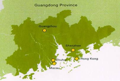
Some of the open towns listed above have been subsequently elevated to open cities (see Annex A for China’s method of classification), and in some cases the towns displayed a more rapid rate of population growth than the cities. Similarly, some of the open cities have been subsequently amalgamated with Guanzhou, or with other cities. The economic region or zone that is known as the Pear River Delta therefore changes frequently. The map below is based upon recent information from the Hong Kong Government (http://www.info.gov.hk/hk2030/hk2030content/con_digest/map_PRD.htm). The region shown in dark green does not include Shantou and most of the “peripheral” cities listed above, but appears to include the basic area of 42,000 square kilometres mentioned above.
|
|
|
The British Colonial Government
of Hong Kong encouraged manufacturing in the colony during the early 1950s as
a result of the decline in entrepôt activities following the establishment of
the People’s Republic of China. This
decline was exacerbated by the trade embargo against China following the
outbreak of the Korean War. The colony quickly initiated
labour-intensive manufacturing activities and became a major exporter of
clothing and toys made of cloth, as well as clocks, watches and transistor
radios. By the middle of the 1970s,
however, unemployment was reduced to a very low level and wage rates began to
increase rapidly. When China implemented its “open
door” policy in the 1980s, Hong Kong’s manufacturers were already seeking to
shift a large portion of their production offshore, with a view to escaping
the rising labour costs. As a result,
much of the machinery that was virtually obsolete in Hong Kong was
transported across the canal, which forms the northern boundary of Hong
Kong’s New Territories, and re-established in Shenzhen. At that time, Shenzen was a
relatively small town, but was quickly elevated to a city (refer to Annex A). Most of
the initial infrastructure for the Special Economic Zone (SEZ) was internally
financed through down payments by the newly formed joint-venture enterprises
(JVEs) for land-use rights and for other imposts. Construction proceeded rapidly. The outsourcing of the
labour-intensive operations associated with Hong Kong’s manufacturing
activities added substantially to the capacity of the colony to continue
exporting manufactured goods, and gave rise to exports of semi-finished
products and components from Shenzhen into Hong Kong. The success of these ventures
soon became apparent to multinational enterprises in other countries, and
they also formed joint ventures in Shenzhen.
Many of these were brokered by Hong Kong’s financial institutions and
were assisted by other service establishments in Hong Kong. As a result, Hong Kong’s services sector
grew at a much faster rate, compared to manufacturing, especially after a
greater proportion of the total product was manufactured in Shenzhen. During Shenzhen SEZ’s first five
or six years, most of the labour supply was obtained through migrant workers
who fulfilled short-term contracts and returned to their original towns and
villages. The wage rates in Shenzhen
were substantially lower than those in Hong Kong, but well above the rates
that prevailed in the migrant workers’ towns and villages. The work force needed by the JVEs was
therefore met by young Chinese who sought increased savings within a relatively
short period of time. Many visitors to Shenzhen during
that period expressed dismay at the unappealing nature of the dormitory-style
accommodation and the long hours or work.
The SEZ appeared to reflect much of the exploitation that was
characteristic of Shanghai and other coastal cities during the interwar
period (refer to the Position
Paper on Urban Development). This
began to change during the second half of the 1980s. Shenzhen experienced upward
pressures in wages and costs in a way that was similar to Hong Kong’s
experiences a decade before. The cost
of land-use rights rose rapidly, together with wage rates for both skilled
and unskilled labour. Moreover, the
new migrant workers during that period sought permanent residency. Infrastructure needs, as well as the
supply of urban services, added further to rising costs. Zhuhai SEZ and Shantou SEZ
picked up some of this “spillover”, but they also experienced rising
costs. The smaller cities and towns
between the SEZs and Guangzhou then expanded with the resulting relocations. This expansion was associated
with an emerging pattern of specialisation and comparative advantage among
the many open towns. For example,
Gulong became a “lamp and lantern” town, aided by Hong Kong and Taiwanese
investors. Humen became known as a
garment town; Huizhou attracted several large electronic manufactures; and
both Foshan and Dongguan became centres for the IT industry. The general pattern of
specialisation during the 1990s was apparently initiated by chance. A leading manufacturer moved into a
particular town and created a supply of trained workers that could be “bid
away” by competing manufacturers. It
is likely also that financial institutions in Hong Kong and Macao aided this
process by syndicating groups of investors who were engaged in similar
activities. As
a result of these developments, the Pearl River Delta has been among the
fastest growing areas in China. For
the past few years, the growth in GDP averaged about 13 percent per annum,
with a contribution to GDP of RMB 643.89 billion in 1999, and with exports
amounting to US$67.4 billion. The
per capita GDP of the region is more than 3 times of the national value and 2
times of the average for Guangdong Province.
In addition, 90 per cent of the 100 million foreign tourists who visit
to Guangdong every year enter through the Pearl River Delta. In
key areas such as exports and foreign direct investment, the Pearl River
Delta accounts for 92 per cent and 84 per cent, respectively, of Guangdong’s
total. Perhaps even more
impressively, in 2000 the region accounted for 34 per cent of China’s total
exports and 30 per cent of its total foreign direct investment. This
growth created substantial pressures for infrastructure development and for
the supply of urban services. Success
in meeting these requirements has generally been good, but it varies among
the respective municipal authorities. |
||
|
|
The cities within the mainland
portion of the Delta, including Guangzhou, are administered by the Guangdong Provincial
Government. There is no separate
administrative entity for the PRD.
Although the rivalry among the cities in the PRD accounts for much of
its dynamic quality, the lack of overall planning also creates some
difficulties. An example of this is Panyu
City, for which the following account is a summary of greater detail provided
by the South China Morning Post (http://www.scmp.com)
in an article by Tom Mitchell entitled “Daring to Rise Again”, 28 January
2002. Panyu occupies the land south of
Guanzhou, on the southern bank of the Pearl River. It was classified as a city by the State Council in the latter
part of the 1980s, and undertook at that time substantial construction in
roadways and bridges. In the year 2000, the Guangzhou
Municipal Government proposed that Panyu City be amalgamated into the larger
city’s administrative structure. This
meant that it would be relegated in status to a district, rather than a city,
and would come under the fiscal control of Guangzhou. According to Mitchell, a local
anecdote suggests that Panyu’s cause was lost as soon as they showed off
their new government headquarters.
This elaborate building was far larger than that in Guangzhou and even
bigger than the site of the provincial government offices. The then Vice-Premier Zhu Rongji visited
the city for an inspection and, according to the story, was enraged at the
extravagance of the building. In June of that year, Panyu City
officially became part of Guangzhou.
The case, as presented by the Municipal Government of Guangzhou,
apparently had merits on its own. The
expansion of Guangzhou is restricted on the north by the Baiyun Mountains and
is bounded by the Pearl River to the west and the south. As stated in Mitchell’s article: While there is considerable room further north beyond the
Baiyun Mountains, too much development in that direction would threaten the
city's water supply. About 65 per
cent of Guangzhou's water comes from the Liuxi Reservoir in Conghua, another
city that Guangzhou intends to annex as a district. Because of this, and to the detriment of Conghua's economy,
development there has been severely limited. Some development could be funnelled to the city's east
where a new district - Tianhe - was established with the intention that it
would eventually become Guangzhou's new commercial and administrative
centre. Beyond Tianhe and Guangzhou's
river port at Huangpu, however, the city soon runs up against the intensively
industrialised city of Dongguan, a once-agrarian county that has become
China's third largest exporter after Shanghai and Shenzhen. By absorbing Panyu as a district, Guangzhou not only
acquired space to grow but also secured a strategically crucial outlet to the
sea and a coastline with water deep enough to build a deep-water port. For many centuries, Huangpu was China’s No. 1 port, but
this status was lost after 1949, especially with Hong Kong’s rapid
development in the 1960s and 1970s.
The current rivalry between Guangzhou and Hong Kong remains intense
through the desire of the former to reverse this 30-year gap. Again from the South China Morning Post article: Because Guangzhou's former greatness was so closely tied
to that of its port, city officials are determined to again develop a first-class
harbour. The existing port at Huangpu, however, is inadequate for
the task. As a river facility prone
to silting, it lacks the capacity to handle the ever-larger container ships
used to transport much of the world's trade. This is where Panyu - and in particular its former island
district of Nansha - enter the picture.
Nansha and another island just to its south, Longxue, are located at
precisely the point where the Pearl River widens dramatically, making it easier
for large ships to manoeuvre. More importantly, the Nansha and
Longxue coastlines can - at depths reaching 15 metres - accommodate
50,000-tonne vessels. Ultimately,
Guangzhou hopes to build as many as 40 50,000-tonne berths on Longxue. It also plans to build a steel mill, a
shipyard and other heavy industrial facilities on Nansha, to be linked to the
city centre by a new expressway and subway line. This is likely to divert some of
the freight that now enters the PRD through Hong Kong. Other aspirational conflicts
exist within the region. Shenzhen
moved well away from its appearance as a “company town” with unattractive
dormitories for migrant workers. To
most mainlanders,
Shenzhen is seen as a safe and beautiful "garden city" with modern
skyscrapers and Western-style entertainment parks. The latter include a theme park displaying models of some of
the world's most recognised structures, such as the Eiffel Tower. Shenzhen is also competing with Hong Kong as a services
centre, with rapid expansion in banking, finance and insurance. Hong Kong’s services are still thriving,
but they operate at a disadvantage on the mainland since Hong Kong SAR
functions with different laws and accounting standards, as was required when
the handover arrangements were first discussed in 1984. The objective of urban development in the PRD should
include the following: v Extend to pattern of
specialisation and comparative advantage without increasing the city’s
vulnerability to international downturns in the demand for the specialised
products. v Continue the rivalry
among cities but avoid unnecessary duplication that could be wasteful. v Continue to solve urban
problems as they arise, but begin longer term planning with a view to
reducing the number of urban problems that are likely to arise in the future. v Use longer term
planning to minimise the delays associated with urban expansion and
relocation. In the next section, we look at current development plans
for the region. |
|
|
v the central area
dominated by Guangzhou, v the east bank from
Shenzhen to Guangzhou, and v the west bank from
Zhuhai to Guangzhou. Guangzhou is expected to change its main function by
developing its tertiary industries.
These will include international finance, trade, scientific research
and international business. The focus
will be on supplying these services to the PRD region. Other cities in the central area, including Foshan,
Zhaoqing and Shunde, are expected to place increased emphasis on services
such as science and technology, finance, commerce, trade and tourism. The focus will be on the supply of these
services to enterprises in their respective cities and their immediate
hinterlands. Shenzhen will strengthen its existing functions in
finance, foreign trade, commerce, and transfer of technology. It will also
expand its export-oriented economy with increased emphasis on
capital-intensive and technology-intensive industries. Its intention is to realise increased
complementarity with Hong Kong’s services sector and to supply these services
to Southern China. Other cities in the eastern group include Dongguan and
Huizhou. They are expected to develop
service industries that focus on foreign trade, as well as industrial
development and scientific research aimed mainly at communications equipment,
electronic equipment and instruments, energy and chemicals. The western city group includes Zhuhai, Zhongshan and
Jiangmen, which will development industries that rely more heavily on freight
transport. This includes, energy,
heavy chemicals, machinery and bio-pharmaceuticals. |
||
|
Transport planning includes the
following: v
A subway system and a high-speed light rail network
that will connect major cities in the PRD.
Feasibility studies for this are reported to be in progress. v
Priority transport for Guangzhou includes a light
rail line to the airport and a light rail system connecting Guangzhou to
Foshan, Shunde and Panyu. v
Guangzhou will extend its subway network to consist
eventually of seven lines with a total length of 206 kilometres. v
The 32.4-kilometre rail line, consisting of 23 stations,
is expected to include a new bridge across the Pearl River and connect
locations in the main portion of Guangzhou with the city’s Panyu District. v
Guangdong provincial officials are negotiating with
the governments in Hong Kong and Macao special administrative regions (SARs)
to eventually link Guangdong's metro and light rail networks to
transportation systems in the two SARs. v
Shenzhen Special Economic Zone is expected to begin
construction of its first subway line in the near future. This 18-station line will ultimately cost
about RMB 10.6 billion and is expected to be in operation within four
years. The line will start at the
city's Luohu and Huanggan checkpoints, which lie on the Hong Kong SAR border,
and cross Shenzhen's business-oriented Futian and Luohu districts to end in
the northern part of the city. v
Preliminary study has also begun for a bridge
across the Pearl River that would link the Zhuhai Special Economic Zone with
Hong Kong SAR. This follows the trend mentioned
in the case study relating to Chongqing, for which a large part of the
transport planning focuses on the major city – Guangzhou – in the case, with
Shenzhen and Zhuhai next in terms of priorities. Presumably, the rationale is to set the main trunk routes
within the three sub-regions, and to allow the intermediate cities to adjust
to these main routes. However, additional attention
will need to be directed, in the near future, on the capacity of the existing
rail and road network in the western portion to satisfy the increased demand
for heavy freight movements. This
must be matched with the planning horizon for a possible bridge near the
southern end of the PRD. Similarly, the increased flow of
passenger traffic in the eastern sub-region will require better linkages with
Hong Kong’s passenger rail system. At
the moment, travel time by rail from Shenzhen to Hong Kong Island is almost
as long as the travel time from Shenzhen to Guangzhou. This results from the need of through
trains to use the MRT lines in Hong Kong, requiring stops at all
stations. Most
of the elements for successful longer-term planning for the Pearl River Delta
appear to be in place. The less
certain aspect is whether these elements can be integrated into a coherent
structure that allows planning to be focused and detailed, but also retains
sufficient flexibility to adjust to the rapidly changing economic and social
circumstances. |
||
|
28 January 2002, “Fragments fuse
into economic giant”, Tom Mitchell. A book
that was edited by Joseph Y.S. Cheng and published by City University of Hong
Kong Press in December 1998 remains current and contains a good collection of
academic studies on the region. It is
entitled: The Guangdong Development Model and Its Challenges. Another
useful book for the broader issues of urban development, including China, was
published in 1995 by the United Nations University and was edited by Lo
Fu-chen and Yeung Yie-man entitled Emerging World Cities in Pacific Asia. The full text is available online at: http://www.unu.edu/unupress/backlist-index.html Recent
plans for transport infrastructure were reported by China Daily (http://www.chinadaily.com.cn) on 14
February 2001 in “South ready to lay tracks”. We have not been able to obtain similar information since then. Recent
information on Panyu District is available on their Internet site: http://www.pyhengli.com/english/invest.htm A
South China business guide gives useful details about the cities in the
region: http://www.southcn.com/english/bizguide/bizopp/200109210188.htm The
map of the region is a slightly altered graphic from the Hong Kong Government
at: http://www.info.gov.hk/hk2030/hk2030content/con_digest/map_PRD.htm |
||
|
|
CHINA’S CLASSIFICATION OF CITIES
AND TOWNS Some
confusion exists with China’s classifications of cities and towns, and the
following reproduces the rules and guidelines as closely as we could
determine them. Part of the problem
arises from decisions made the State Council, upon which the principal
responsibility for the classification resides, and from the administrative
recommendations of the Ministry of Civil Affairs. The Ministry follows government policy, but this changed over
time and some discretion was allowed with each change. Urban
areas in China consist of towns (zhen) and cities (chengshi). Only cities are incorporated with the
capacity to raise revenue, to issue bonds or borrow funds and to operate with
a fiscal budget. Towns come under the
fiscal control of county-level governments.
As a consequence, towns typically seek to have their status upgraded
as soon as possible. When the People’s Republic of
China was formed in 1949, the rules for an upgrade in status were not rigidly
set. A relatively large number of
cities therefore came into existence at that time. This was changed in 1955 with
the State Council’s “Decision on the Establishment of City and Town
Government”. The criteria for a city
were based mainly on population size (100,000 or more), but smaller
populations were allowed for specific economic and political functions. For example, important industrial or
mining centres could achieve the status of a city even if they had less than
100,000 residents. Similarly, border
towns were sometimes classified as cities in order to facilitate a defence
establishment. The guidelines were altered in
1963 to place more emphasis on economic function. Existing cities with more than 20 per cent of the population
engaged in agricultural activities were relegated to a town, unless special
approval was granted by the State Council, upon the recommendation of the
relevant government authority. The rules were again changed in
1983 by the Ministry of Civil Affairs, and the new criteria were codified in 1986
in the “Notice of the Report of the Adjustment of the Criteria of
Establishing City Government and the Conditions for City Governing
County”. The new classification as a
city required a non-agricultural population of more than 60,000 and an annual
gross urban product of RMB 200 million.
It was also necessary to demonstrate that the urban area was an
important economic centre, and such a demonstration sometimes allowed the
population size and annual gross urban product to be lower. Similar changes were made to the
classification of towns, and this is further complicated by the differences
among provinces and autonomous regions.
These governments were responsible for the classification of towns. Communes were abolished in early
part of the 1980s, and in 1985 an area was classified as a town under the
following criteria: v
it was the location of the county-level government
(the county seat); or v
it was a township seat in a township having a total
population of more than 20,000, where the township seat had a proportion of a
non-agricultural population of more than 10 per cent; or v
it was a township seat in a township having a total
population of less than 20,000, where the township seat had a
non-agricultural population of more than 2,000; or v
it was located in a remote area, a mountainous
area, a small-sized mining area, a small harbour, a tourism area or a border
area with a non-agricultural population of less than 2,000. In China, the urban population
refers to the number of people living in areas that are under the
jurisdiction of cities or towns, with cities and towns defined as above. Rural population refers to the population
of counties excluding those living in towns.
However, as noted in the classification rules, the areas under the
jurisdiction of cities and towns include people who are engaged in
agricultural activities. Therefore,
the percentages based upon this classification will overstate the normally
accepted definition of urban residents. In partial compensate for this
anomaly, official population data for cities will show an agricultural
population and a non-agricultural population, with the former denoting the
population of counties under the jurisdiction of the city government. Other adjustments are made for the
agricultural population that reside in areas under the jurisdiction of
towns. These adjustments are done with
the view to bringing China’s urbanisation rate into closer conformity with
international conventions. While this
seems to have been achieved for China as a whole, it will not necessarily be
reflected in the urbanisation rates for individual provinces. A further complication arises
from two types of towns. A town that
is so designated by the provincial government (or the government of an
autonomous regions) is a “designated town” (jianzhizhen)
and, as noted above, it is considered to be an urban area. Some communities that lack this designated
may nevertheless be called a market town (jinzhen
or xiangzhen) but are not counted as having an
urban population. It is therefore
necessary to clarify the type of town for which data are given. It is also important to be wary
of urbanisation rates in the past.
Much of the change in the proportions can be attributed to changes in
the classification of towns and in the amalgamation of counties into cities. It may
also help to view townships as purely administrative divisions within
counties, with towns being urban areas within the townships. Cities will typically have counties under
their jurisdiction, which means they also have townships under their
jurisdiction. Offices for these
administrative divisions are often retained when the amalgamation with a city
occurs. As the population of the
towns become extended, so that they form part of the built-up area of a city,
they may be referred to as districts.
|
|
|
|
OTHER CITY CLUSTERS IN CHINA In
addition to the cluster of cities just described for the Pearl River Delta,
four similar clusters have been recognised: Liaodong Peninsula extending from Dalian to Shenyang.
Shenyang and Anshan are considered to be co-centres, with Dalian as
the port city. Other cities in the
cluster include Fushun, Benxi and Liaoyang.
All are connected by railway lines and express roadways. The region is dominated by heavy industry. Beijing-Tianjin-Tangshan. Beijing
is the dominant city, with Tianjin as the port city. Tangshan and Tanggu are also included in
the cluster. The railway line from
Beijing to Shenyang connects all of these cities. Yangtze River Delta from Shanghai to Nanging.
Although it is along the coast, Shanghai is nevertheless the centre of
the cluster. Other cities within the
cluster include Hangzhou, Wuxi, Suzhou, Changzhou, Ningbo and Nantong. Railway lines, as well as the Grand Canal
and the Yangtze River, provide the major transport linkages. Chongqing Municipality. This is
discussed in more detail in a Chamber
Position Paper. It differs from
the clusters just described since the cities within the cluster are also
within the jurisdiction of the Chongqing Municipal Government. The notion of a clustering of cities is
nevertheless maintained, and may even be strengthened with a common
administrative unit. The clusters
are all situated in either river deltas or plains, with abundant natural
resources and a relatively long history of economic interdependence. In all of these areas, new cities are
being formed and the growth rate of towns is well above the national average. Although
aggregate data are not available for these five city clusters (including the
Pearl River Delta) is seems almost certain that jointly they could account
for well over half of exports and foreign direct investment in China. This
would appear to support the belief that, for China, strong growth for a major
city in a particular region is a necessary condition for rapid growth in
towns and smaller cities within that region. |
|
|
|
||