|
|
|

|
|
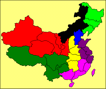
Inner Mongolia
is shown in black. Note that Chinese names are in MingLiU (Chinese Traditional) screen
font. This may appear as question
marks or other symbols if that font is not installed on your browser. |
||||||||||||||||||||||||||||||||||||||||||||||||||||||||||||||||||||||||||||||||||||||||||||||||||||||||||||||||||||
|
|
Regional Capital: Hohhot. Average temperatures: -23 deg C to -10 deg C in January; 17 deg C
to 26 deg C in July. Physical features: Land area is 1,183,000 square kilometres. In the northeast of the region lies the
Greater Hinggan Range with dense forests.
To the west of the range is the Hulunbuir Plateau, with vast
grasslands for grazing. The rest of
Inner Mongolia consists of numerous deserts, or salt and alkali lakes, with
scattered highlands. Rivers and lakes: The Yellow River enters part of the region, as does
the Ergun River and the upper reaches of the Liao River. Lake Hulun is in the plateau region in the
northeastern part of the province. Administrative divisions: 16 cities, 18 counties, 51 banners and 3 autonomous
banners. Historical significance: Inner Mongolia
Autonomous Region, what is now the Republic of Mongolia and the Amur
Administrative Region of Russia comprised the homeland of the Mongols. Genghis Khan united the various tribes in
the Asian grasslands in 1206 and established a vast empire. His grandson, Kublai Khan completed the
conquest of southern China, the stronghold of the Song Dynasty, in 1279 and
become the first emperor of the Yuan Dynasty.
. Mongol conquests succeeded mainly from the
mobility achieved with horses and with both skill and cunning in the use of
weapons. This did not contribute to
the ability to rule and the Yuan Dynasty was overthrown in 1368 by a group of
Chinese rebels who founded the Ming Dynasty. The cultural heritage of Mongols is not
regarded as significant (except, perhaps for Xanadu Palace which lies about
231 kilometres north of Beijing at Duolin) since the Mongols borrowed heavily
from the culture of the Chinese during their reign. They did, however, establish roads from
Beijing to Hohhot and on to Baotou,
which opened the way for migration from the south. They also initiated a variety of public
works projects in northern China, including renovation of the Grand Canal. Currently, about 10 per cent of the Inner
Mongolian population are Mongols and remain practitioners of Tibetan
Buddhism, with some Muslims. The
remainder of the population consists of Han Chinese, and other ethnic groups
including: Hui(回), Manchu(滿), Daur(達幹爾), Ewenki(鄂溫克), Oroqen(鄂倫春), Korean(朝鮮), Zhuang(壯), Tibetan(藏), and Tu(土). China
administered most of Mongolia during the Ming and Manchu reigns, but the Republic
of Mongolia was established 10 years after the collapse of the Manchus (Qing
Dynasty) in 1911. It was Mao Zedong’s
intention to include both Inner Mongolia and Outer Mongolia as autonomous
states in the Chinese Federation, but Outer Mongolia remained firmly under
Soviet control in the period after 1949. |
||||||||||||||||||||||||||||||||||||||||||||||||||||||||||||||||||||||||||||||||||||||||||||||||||||||||||||||||||||
|
|
|
||||||||||||||||||||||||||||||||||||||||||||||||||||||||||||||||||||||||||||||||||||||||||||||||||||||||||||||||||||
|
|
Notes: *In real terms |
||||||||||||||||||||||||||||||||||||||||||||||||||||||||||||||||||||||||||||||||||||||||||||||||||||||||||||||||||||
|
|
|
Roadways - The road network in the region is well developed
and the Hohhot-Baotou Expressway is the major highway in Inner Mongolia. This is to be upgraded as part of the
current Five-Year Plan. Air Transport - Air travel is becoming the major source of
transport for the region and the Hohhot airport has more
than 47 air routes to major cities in China.
Small aircraft and helicopters are used increasingly with livestock
production. Telecommunications -By February-2001, the telephone penetration rate
in the region jumped from 7.5 per cent in 1998 to 32.2 pre cent and
subscribers for mobile phone reached 1.1 million. Power Supply - With the power generating capacity of 6.2
million kWh, the region has become a major power supplier for China's
Northeast Power Grid, the Beijing-Tianjin-Tangshan Power Grid, and for
Mongolia. |
|||||||||||||||||||||||||||||||||||||||||||||||||||||||||||||||||||||||||||||||||||||||||||||||||||||||||||||||||||
|
|
The grasslands contribute to major
livestock-breeding activities. The
region has the largest number of horses, cattle, sheep including fine-wool
sheep, white goats and camels. Fine
wool, cashmere and camelhair cloth are important by-products. In 1999, milk production in the region
ranked third in the country. |
||||||||||||||||||||||||||||||||||||||||||||||||||||||||||||||||||||||||||||||||||||||||||||||||||||||||||||||||||||
|
|
As noted
previously, Inner Mongolia is an important base of iron and steel
industry. The role of the Baotou Iron
and Steel Company(包頭鋼鐵公司)is significant in the
development of this industry in China.
Textile industry
is one of the significant industries in the region. The Ordos Group (鄂爾多斯集團)is one of the best known manufacturers. |
||||||||||||||||||||||||||||||||||||||||||||||||||||||||||||||||||||||||||||||||||||||||||||||||||||||||||||||||||||
|
|
This is the
largest of the state-level ETDZ in Inner Mongolia. Approved by the State Council in 1992, it focuses
on electronics, textile, machinery, light industries including food
processing, biological and medical supplies and chemicals. Baotou
Rare Earth High and New Technological Development Zone (包頭稀土高新技術產業開發區) This is another
state-level ETDZ and specialises in the processing of rare earth
minerals. The zone has 253 enterprises
and attracted RMB 2.2 billion in investment.
|
||||||||||||||||||||||||||||||||||||||||||||||||||||||||||||||||||||||||||||||||||||||||||||||||||||||||||||||||||||
|
|
Major department
stores and shopping centres in Inner Mongolia include Inner Mongolia Minzu
Market(內蒙古民族商場股份有限公司), Baotou Department Store (包頭市百貨大樓集團公司), Inner Mongolia Tianyuan
Commercial Building (內蒙古天元商廈), Inner Mongolia Xinshiji
Mall(內蒙古新世紀廣場)and Chifeng
Department Store(赤峰市百貨大樓). |
||||||||||||||||||||||||||||||||||||||||||||||||||||||||||||||||||||||||||||||||||||||||||||||||||||||||||||||||||||
|
|
Ø Hohhot Ø Baotou Eastern industrial region – this includes the portion of Inner Mongolia from Ulan
Hot to the northern border. Ø
Chifeng Ø Tongliao |
||||||||||||||||||||||||||||||||||||||||||||||||||||||||||||||||||||||||||||||||||||||||||||||||||||||||||||||||||||
|
Hohhot is about 400 kilometres from Beijing
in a straight line. The rail
connection is longer as it passes through Zhangjiakou in Hebei Province, then
goes southwest to Datong and then directly north to Jining (集寧)in Inner Mongolia, which is part of the main line to
Ulaan Baatar in the Republic of Mongolia.
Hohhot is served from an east-west line from Jining. Current plans are to construct a more
direct rail link between Jining and Zhangjiakou, which will reduce the travel
time between Hohhot and Beijing to 5 hours. The city is the administrative and
educational centre of the region. Its
history dates back to the 16th century and was originally built around
temples and lamaseries. Hohhot means
“blue skies” in Mongolian and this most probably arose from is status as one
of the sunniest cities in the region, and probably also in China. Hide and wool are the main activities,
although diesel machinery, fertilisers and sugar refining are important
activities. |
|||||||||||||||||||||||||||||||||||||||||||||||||||||||||||||||||||||||||||||||||||||||||||||||||||||||||||||||||||||
|
Baotou lies on the northernmost portion of
the Yellow River, about 150 kilometres west of Hohhot. Baotou means “land of the deer” in Mongolian,
which gives an indication of its early importance as a source of water. Industrial development followed the
exploitation of coal, iron ore and mineral deposits in the region and it is
substantially more industrialised that the other cities in the region. |
|||||||||||||||||||||||||||||||||||||||||||||||||||||||||||||||||||||||||||||||||||||||||||||||||||||||||||||||||||||
|
Chifeng 赤峰: |
Chifeng is the principal city in the
eastern part of Inner Mongolia. It is
less then 25 kilometres from the border with Liaoning Province and is
therefore more closely related to the trading activities of that province,
than to those of the central and eastern part of Inner Mongolia. |
||||||||||||||||||||||||||||||||||||||||||||||||||||||||||||||||||||||||||||||||||||||||||||||||||||||||||||||||||||
|
We presume that Hulunbeier is one of the
communities near Lake Hulun in the northeastern part of the region. Other cities in that area are Manzouli and
Hailar and both are close to Russian Siberia. |
|||||||||||||||||||||||||||||||||||||||||||||||||||||||||||||||||||||||||||||||||||||||||||||||||||||||||||||||||||||
|
Tongliao
is about 300 kilometres northeast of Chifeng and about 60 kilometres from the
border with Jilin Province. |
|||||||||||||||||||||||||||||||||||||||||||||||||||||||||||||||||||||||||||||||||||||||||||||||||||||||||||||||||||||
|
The name “bayan” appears frequently in the
central portion of Inner Mongolia and we are unable to establish the location
of this specific one. |
|||||||||||||||||||||||||||||||||||||||||||||||||||||||||||||||||||||||||||||||||||||||||||||||||||||||||||||||||||||
|
|
Hong Kong Trade Development
Council (http://www.tdctrade.com) |
||||||||||||||||||||||||||||||||||||||||||||||||||||||||||||||||||||||||||||||||||||||||||||||||||||||||||||||||||||
|
|
|
||||||||||||||||||||||||||||||||||||||||||||||||||||||||||||||||||||||||||||||||||||||||||||||||||||||||||||||||||||